The Ha Giang Loop is Vietnam’s most legendary motorbike route, attracting riders from around the world with its towering limestone mountains, deep valleys, and remote ethnic villages near the Chinese border. But what is the Ha Giang Loop exactly, and why has it become one of Southeast Asia’s most unforgettable adventure journeys?
With guidance from Frontier Travel Vietnam, this guide explains everything you need to know about the route, landscapes, riding experience, and cultural highlights of Northern Vietnam’s most iconic road trip.
1. What is the Ha Giang Loop?
The Ha Giang Loop is a circular motorbike route in Northern Vietnam that starts and ends in Ha Giang City. The journey takes riders through dramatic mountain passes, remote valleys, and traditional ethnic minority villages near the China border. Unlike standard tourist routes, this loop is famous for its raw landscapes, technical roads, and deeply immersive cultural experiences.
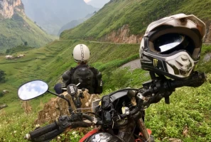
Riding along the northern loop line to answer what is the Ha Giang Loop.
For many riders, this circular track is not just a road trip but a true adventure through Vietnam’s wildest frontier. To understand what is the Ha Giang loop, you have to experience the total sense of liberation that comes from riding through valleys that feel completely untouched by modern civilization. It is an exploration of geography, history, and ancient traditions.
2. Where is the Ha Giang Loop located?
To fully understand what the Ha Giang Loop is, you must first recognize its geographic placement at the absolute edge of Vietnam, where rugged mountains and remote highland valleys define the route. This unique location creates breathtaking landscapes and determines seasonal conditions, making it essential to choose the best time to do Ha Giang Loop.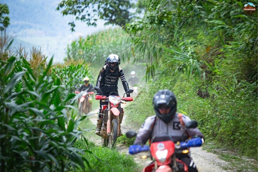
Mapping the extreme geographic edge where massive limestone karsts dominate.
2.1 Geographic location
Ha Giang is Vietnam’s northernmost province, directly bordering Yunnan Province in China. The region is famous for its rugged mountains, deep valleys, and remote highland scenery that remain largely untouched by mass tourism. The extreme border geography explains what is the Ha Giang loop in terms of its steep cliffs and isolation, as the landscape is formed by massive tectonic movements that created sharp limestone karsts over millions of years.
2.2 Main areas along the loop
The classic loop passes through several famous destinations:
- Quan Ba Heaven Gate
- Yen Minh pine hills
- Dong Van Karst Plateau
- Ma Pi Leng Pass
- Meo Vac Valley
Each section offers completely different landscapes and riding experiences. As you transition between these legendary districts, you will discover that what is the Ha Giang loop changes daily, shifting from soft pine forests to harsh stone formations.
2.3 Typical route overview
Most riders follow the classic route: Ha Giang City → Quan Ba → Yen Minh → Dong Van → Ma Pi Leng → Meo Vac → Ha Giang City. Depending on your travel style, the loop usually takes between 3 and 5 days to complete. Understanding the distance between these stops helps define what is the ha giang loop for your specific holiday schedule, as the actual journey spans roughly 350 kilometers of winding roads.
3. Why is the Ha Giang Loop so famous?
The rising global popularity of this destination has left many travelers wondering: what is the Ha Giang loop and why does it captivate so many hearts? The answer lies in its unique combination of natural scale and human elements.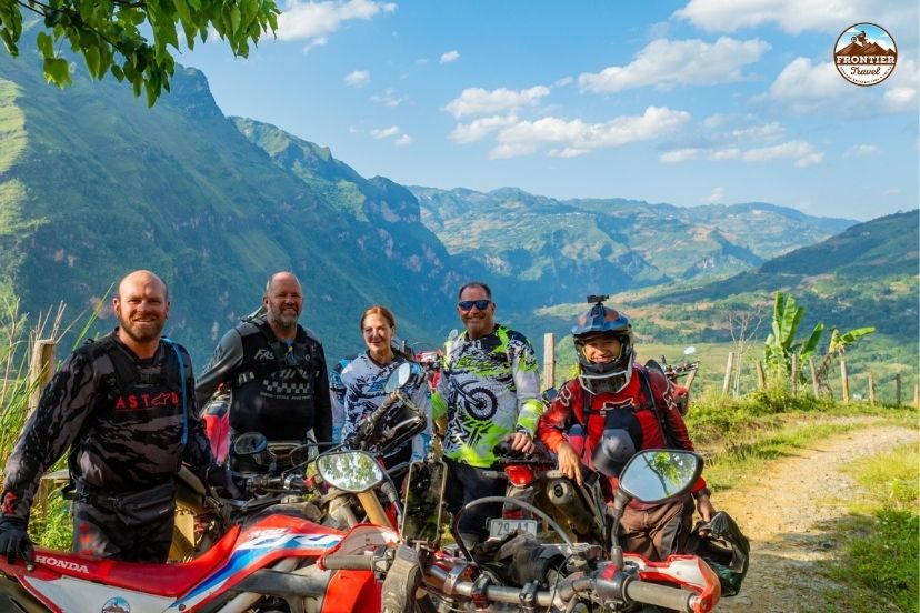
Standing on high cliffside roads looking out over giant stone teeth
3.1 Spectacular mountain landscapes
The Ha Giang Loop is considered one of the most beautiful mountain routes in Southeast Asia. Riders travel through giant limestone peaks, narrow valleys, deep canyons, and endless mountain roads surrounded by clouds. When people show photos of massive stone teeth rising from the earth, they are demonstrating Ha Giang loop at its most visual.
3.2 Legendary mountain passes
Routes like Ma Pi Leng Pass are world-famous for their dramatic cliffside scenery and sharp mountain curves. Many riders describe this section as the ultimate highlight of the entire journey. These roads cling tightly to the mountain walls, showing you what is the Ha Giang loop in terms of sheer engineering marvels and spine-tingling heights.
3.3 Authentic ethnic culture
Unlike more developed tourist destinations, Ha Giang still preserves strong ethnic traditions. Travelers regularly encounter Hmong, Dao, Tay, and Lo Lo communities living traditional lifestyles in remote villages. This deep human connection explains Ha Giang loop for cultural seekers who want to see living history up close.
3.4 Sense of adventure & freedom
The combination of remote roads, changing weather, and endless mountain scenery creates a strong feeling of freedom and exploration that few destinations can match. For anyone seeking to escape the routine of daily life, experiencing what is the Ha Giang loop is the ultimate antidote to modern stress.
4. What is the riding experience like?
Navigating the northern frontier requires a clear understanding of what the Ha Giang Loop entails in terms of physical effort, road concentration, and daily stamina. Being aware of these demands helps travelers plan their rides carefully, ensuring they choose the best time to do Ha Giang Loop for safety, comfort, and a rewarding scenic experience.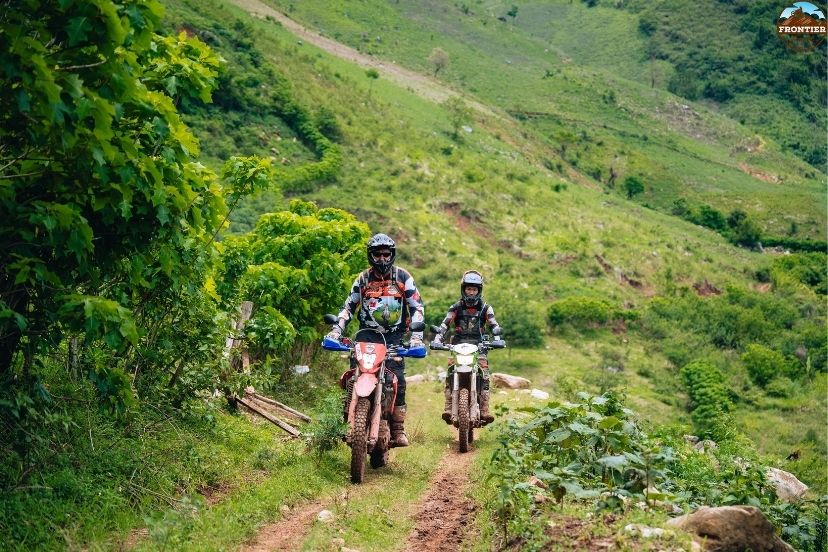
Navigating tricky hairpins and unexpected construction gravel on a mountain pass.
4.1 Mountain roads & terrain
The roads include steep climbs, sharp turns, and winding mountain passes. Most roads are paved, but some sections can become rough or slippery depending on weather conditions. When asking what is the Ha Giang loop like to drive, you must prepare for sudden switchbacks, construction gravel, and tight corners shared with local utility trucks.
4.2 Difficulty level
The loop is considered moderate to challenging in difficulty. Riders need basic motorbike control skills and confidence riding in mountain environments. Weather conditions can increase the challenge significantly. If you are analyzing what is the Ha Giang loop from a safety perspective, your personal riding experience and speed control are the most critical factors.
4.3 Scenic riding experience
One of the most unique parts of the route is the constantly changing scenery. Riders move from green valleys to rocky plateaus, cloud-covered passes, and rivers hidden deep between cliffs. This constant transformation answers what is the Ha Giang loop for active travelers—it is a living, breathing cinematic experience where you are the main director.
5. Main highlights of the Ha Giang Loop
To map out what is the Ha Giang loop effectively, you need to break down the iconic landmarks that define the visual identity of this northern circuit.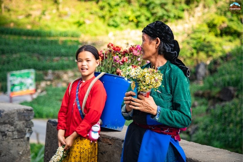
Following the famous emerald ribbon flowing through deep canyons
5.1 Ma Pi Leng Pass
Often called the king of Vietnam’s mountain passes, Ma Pi Leng offers breathtaking cliffside roads overlooking the turquoise Nho Que River below. This singular pass embodies what is the Ha Giang loop for adrenaline seekers, offering a road carved directly into a near-vertical cliff face.
5.2 Dong Van Karst Plateau
This UNESCO Global Geopark is famous for its ancient limestone formations and dramatic rocky landscapes unlike anywhere else in Vietnam. The vast gray stones scattered across the mountains showcase what is the Ha Giang loop from a geological standpoint, telling a story that is hundreds of millions of years old.
5.3 Nho Que River
The emerald-colored river flowing beneath Ma Pi Leng Pass is one of the most photographed places on the loop. Boat trips here provide incredible canyon views. Looking down at this green ribbon from thousands of feet above clarifies what is the Ha Giang loop to nature lovers worldwide.
5.4 Dong Van Old Quarter
A small mountain town filled with old clay houses, local markets, and ethnic culture. It is one of the most popular overnight stops on the route. Relaxing here with a warm bowl of soup helps you appreciate what is the ha giang loop during the peaceful evening hours.
5.5 Quan Ba Heaven Gate
This viewpoint offers panoramic views over the mountains and the famous Twin Mountains of Quan Ba. Standing at this high ridge provides a perfect initial answer to what is the Ha Giang loop, acting as the dramatic gateway to the high plateau.
6. Culture & local life along the Loop
You cannot truly grasp what is the ha giang loop without dedicating time to the diverse human mosaic that occupies these mountainsides.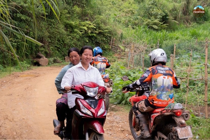
Seeing local families farm corn on near-vertical stone walls.
6.1 Ethnic minority communities
The Ha Giang region is home to many ethnic groups including the Hmong, Dao, Tay, and Lo Lo people. Traditional clothing, local customs, and mountain lifestyles remain an important part of daily life. Their ability to farm corn on steep stone cliffs shows you what is the ha giang loop in terms of human resilience and adaptation.
6.2 Highland markets
Weekly markets in Dong Van and Meo Vac are important gathering places where locals trade goods, livestock, and food while socializing with nearby communities. The explosion of colors from traditional dresses illustrates what is the ha giang loop for travelers looking for authentic community gatherings.
6.3 Homestay experiences
Many travelers stay in traditional homestays built from wood, clay, or bamboo. These stays often include local family-style meals, corn wine, and cultural exchanges with host families. This shared hospitality reveals what is the ha giang loop at its heart—warmth and kindness in a rugged landscape.
7. How many days do you need for the Ha Giang Loop?
When planning your itinerary, allocating the correct amount of time is essential to experience what is the ha giang loop comfortably without exhausting your body. Your chosen timeline will directly impact your overall physical fatigue and cultural immersion opportunities.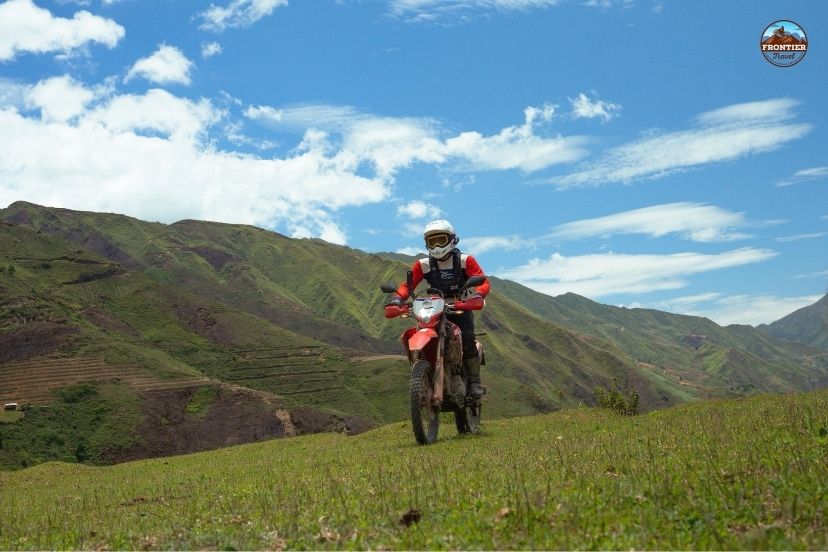
Choosing a balanced 4-day itinerary to prevent heavy saddle fatigue
7.1 3-Day Loop
Suitable for travelers with limited time who want to see the major highlights quickly. While it covers the main roads, a short trip means you will spend most of your daylight hours driving, which limits your understanding of ha giang loop beyond the asphalt.
7.2 4-Day Loop
The most popular and balanced option, offering a sustainable pace with enough time for sightseeing, photography, and cultural experiences. Most travel experts point to this duration when asked what is the ha giang loop ideal travel time, as it prevents extreme rider fatigue.
7.3 5-Day or Longer Loop
Ideal for deeper exploration, including hidden villages, side routes, and more relaxed riding days. Taking a longer trip allows you to discover what is the ha giang loop when you step off the main highway and explore the isolated border fences.
8. Is the Ha Giang Loop safe?
Safety is a common concern for international tourists. Examining what is the ha giang loop regarding risk management helps ensure you return home with only good memories. Proper preparation, clear boundary limits, and defensive habits make a massive difference in handling these high elevations.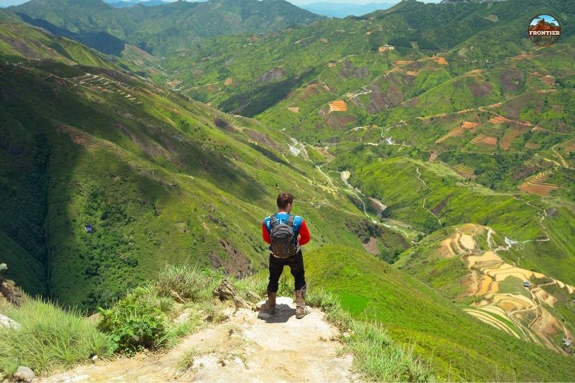
Practicing slow defensive driving rather than racing on steep mountain rims.
8.1 Road safety conditions
The roads are generally safe but require total concentration due to steep cliffs, blind corners, gravel patches, and local traffic. If you treat the mountain passes like a racetrack, you misunderstand what is the ha giang loop—it is a journey meant for slow exploration and defensive driving.
8.2 Weather challenges
Fog, heavy rain, and sudden temperature changes can make riding more difficult, especially during the winter and monsoon seasons. These natural shifts prove ha giang loop for adventure riders—an unpredictable terrain where you must respect the elements.
8.3 Guided tours vs solo riding
Many travelers choose guided tours for added safety, navigation support, and easier access to hidden routes. Booking an organized tour with Frontier reveals what is the ha giang loop when handled by professionals, allowing you to ride as an easyrider or behind a lead guide without navigation stress.
9. Best time to experience the Ha Giang Loop
The climate in Ha Giang varies significantly throughout the year, which means that your travel calendar will directly influence what the Ha Giang Loop experience feels like for your specific trip. By understanding these seasonal changes, you can plan effectively and select the best time to do Ha Giang Loop to enjoy optimal weather, scenic beauty, and safe riding conditions.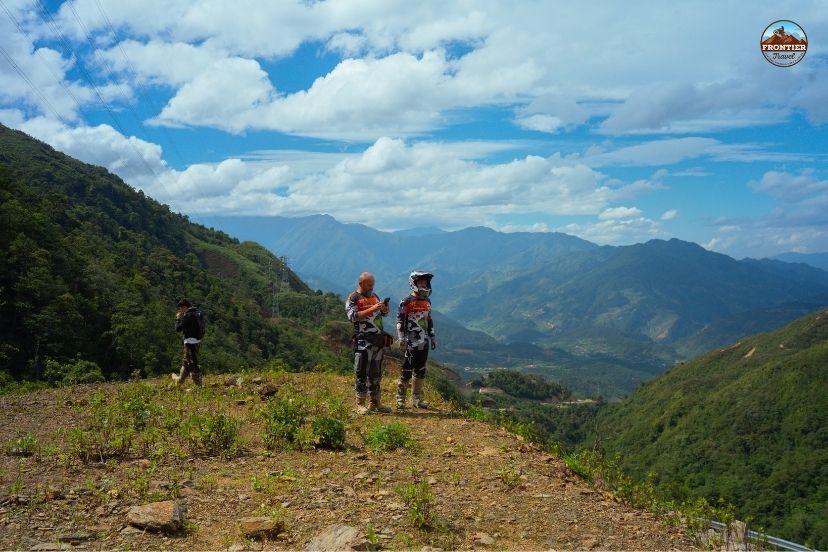
Enjoying crisp mountain air and wild peach blossoms
9.1 September to November
The most popular season thanks to golden rice terraces, clear skies, and stable weather conditions. Many riders choose autumn as the best time to see what is the ha giang loop, enjoying warm afternoons and crisp mountain air.
9.2 March to May
Spring brings green mountains, comfortable temperatures, and beginner-friendly riding conditions. This period presents ha giang loop under soft sunlight, with wild peach blossoms decorating the limestone valleys.
9.3 December to February
Winter creates foggy mountain scenery and dramatic cloud formations, though temperatures can become very cold. This moody atmosphere shows you what is the ha giang loop for photography purists who prefer cinematic mist over blue skies.
9.4 June to August
The rainy season offers lush green landscapes but also slippery roads and possible landslides. This summer stretch shows what is the ha giang loop for hardcore adventurers who don't mind getting wet to see roaring waterfalls at maximum capacity.
10. FAQs – What is the Ha Giang Loop?
To clarify any remaining doubts and provide a comprehensive understanding for first-time visitors, here are the most direct and detailed answers to the most common questions about what the Ha Giang Loop is, including essential travel tips, seasonal insights, road conditions, and cultural highlights.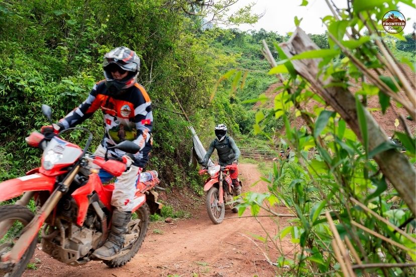
Checking required license permits and side detour miles with a guide.
10.1 Is the Ha Giang Loop worth it?
Yes, it is widely considered one of the best motorbike adventures in Asia. The scale of the landscape and the depth of the culture make it a bucket-list journey that completely redefines what is the ha giang loop for modern adventure travelers.
10.2 Can beginners ride the Ha Giang Loop?
Yes, but guided tours or riding as an easyrider pillion passenger are highly recommended for inexperienced riders. Safety should always come first when discovering what is the ha giang loop.
10.3 How long is the Ha Giang Loop?
The classic circular route is approximately 300 to 350 kilometers long, depending on your chosen side loops and village detours. This distance forms the physical boundary of ha giang loop.
10.4 What is the most famous part of the loop?
Ma Pi Leng Pass is the most iconic section, celebrated worldwide for its dramatic drop into the Nho Que River canyon. It represents the visual climax of what is the ha giang loop.
10.5 Do I need a guide to experience it?
Not necessarily, but professional guides improve safety, fix mechanical issues, handle navigation, and unlock authentic local experiences that answer what is the ha giang loop far better than any smartphone app.
11. Conclusion
The Ha Giang Loop is far more than a simple motorbike route, it is a journey through some of the most dramatic landscapes and authentic cultural regions in Southeast Asia. From towering mountain passes and emerald rivers to ethnic villages hidden deep in the northern highlands, every section of the loop delivers a unique sense of adventure and discovery.
Understanding what is the ha giang loop is about realizing that the destination is the road itself, along with the connections you make with the local people who call these mountains home. With professional support and local knowledge from Frontier Travel Vietnam, travelers can safely experience ha giang loop and create memories that will last a lifetime on Vietnam’s wildest frontier.