The Ha Giang Loop is one of the most legendary motorbike adventures in Southeast Asia, but many travelers ask the same important question before planning their journey: how long is the Ha Giang loop? The answer depends on the route, riding pace, weather conditions, and the type of experience you want in Northern Vietnam’s breathtaking mountain region.
With expert support from Frontier Travel Vietnam, this guide breaks down the full Ha Giang Loop travel time, route variations, and daily riding experiences to help travelers prepare for one of Asia’s most unforgettable road journeys.
1. How long is the Ha Giang Loop?
The classic Ha Giang Loop is approximately 350–400 kilometers long depending on the chosen route variation and detours through remote mountain areas. Most travelers complete the journey within 3–5 days, although some experienced riders attempt shorter itineraries with more intensive riding schedules. When analyzing how long is the Ha Giang loop in terms of geography, the journey usually follows a classic sequence through primary district hubs:
- Ha Giang City
- Quan Ba
- Yen Minh
- Dong Van
- Meo Vac
- Ha Giang City
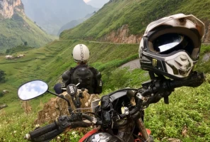
Calculating the distance of the classic route to determine how long is the Ha Giang loop.
Although the total distance may appear manageable on paper, the winding mountain roads and dramatic elevation changes make the journey far more demanding than normal highway riding. Truly understanding how long is the Ha Giang loop requires looking past the odometer and planning for slow mountain transit.
2. Why the Ha Giang Loop takes longer than expected
Many independent motorists arrive in the province expecting to maintain normal highway speeds, only to realize that the local terrain requires a much slower, more deliberate driving pace. This reality alters expectations regarding how long is the Ha Giang loop duration.
Realizing that the local terrain requires a much slower, more deliberate driving pace.
2.1 Mountain roads & technical riding conditions
Unlike flat highway travel, the route is filled with steep mountain climbs, narrow cliffside roads, sharp switchbacks, and blind corners that require constant focus and slower riding speeds. Riders often spend far more time covering short distances than they initially expect.
Some mountain sections, especially around Ma Pi Leng Pass and Dong Van Plateau, demand careful navigation due to steep drops, changing weather, and uneven road surfaces. This naturally increases total riding time each day and alters the perception of how long is the Ha Giang loop journey.
2.2 Frequent scenic stops throughout the journey
One of the main reasons travelers spend longer on the loop is because the scenery constantly changes. Riders frequently stop to enjoy panoramic viewpoints, photograph limestone mountains, admire rice terraces, or simply relax beside rivers and valleys. These stops become a major part of the overall experience rather than just transportation between destinations, directly adding to how long is the Ha Giang loop trip overall.
2.3 Weather & visibility can slow the journey
Mountain weather in Ha Giang changes rapidly throughout the year. Fog, rain, slippery roads, and sudden temperature drops often force riders to reduce speed significantly for safety reasons.
During winter and rainy seasons, visibility can become extremely limited in high-altitude areas. Riders may need to stop frequently or wait for safer road conditions before continuing through mountain passes, making daily travel times highly unpredictable and expanding how long is the Ha Giang loop timeline.
2.4 Cultural experiences extend the adventure
The journey is not only about riding motorcycles, it is also a cultural trip through some of Vietnam’s most remote ethnic communities. Many travelers choose to spend extra time exploring local markets, traditional villages, and family-run homestays along the route.
Sharing meals with local families, attending weekend markets, or enjoying quiet evenings in mountain villages often turns the trip into a much slower and more immersive experience than travelers originally plan, expanding how long is the Ha Giang loop exploration phase.
3. Most popular Ha Giang Loop itinerary durations
Your available holiday schedule will dictate your route choices. Below is a breakdown of how different time frames alter your daily pace and shape how long is the Ha Giang loop adventure.
Balancing your available holiday schedule with different Ha Giang Loop travel time options.
3.1 2-Day Ha Giang Loop (fast-paced adventure)
A 2-day itinerary is the shortest realistic version of the circuit and is mainly suitable for experienced riders with limited travel time. This compressed route focuses heavily on the most iconic highlights such as Dong Van, Meo Vac, and Ma Pi Leng Pass.
However, daily riding hours become very long and physically demanding due to the mountain terrain. This option is generally recommended only for riders who are already comfortable with technical mountain roads and extended riding days, as it radically condenses how long is the Ha Giang loop timeline.
3.2 3-Day Ha Giang Loop (most popular choice)
The 3-day itinerary is considered the most balanced option for most travelers visiting Northern Vietnam. It allows enough time to experience the region’s major highlights without feeling excessively rushed. Typical overnight stops include Yen Minh, Dong Van, and Du Gia or Meo Vac.
Travelers can enjoy scenic viewpoints, local markets, mountain passes, and cultural interactions while still maintaining a comfortable riding pace. This format is especially popular among international travelers joining organized tours with Frontier, offering a practical middle-ground solution to how long is the Ha Giang loop duration question.
3.3 4-Day Ha Giang Loop (balanced & immersive experience)
A 4-day itinerary creates a much more relaxed and rewarding adventure through Ha Giang’s remote mountain landscapes. Riders have additional flexibility to explore hidden valleys, secondary backroads, local villages, and lesser-known viewpoints beyond the standard tourist track.
This slower pace allows travelers to spend more time photographing landscapes, enjoy authentic homestay experiences, reduce physical fatigue from long riding hours, and explore cultural destinations more deeply. For many riders, 4 days provides the ideal answer to how long is the Ha Giang loop for perfect balance.
3.4 5-Day Ha Giang Loop (complete northern Vietnam adventure)
A 5-day itinerary offers the deepest exploration of the Ha Giang region and surrounding highlands. Travelers can include remote destinations such as Lung Cu Flag Tower, Mau Due, Du Gia, and isolated mountain villages rarely visited during shorter tours.
This extended route creates opportunities for more off-the-beaten-path riding, slower scenic exploration, additional cultural interaction, and better adaptation to weather conditions. Travelers seeking a full adventure experience with maximum immersion often consider 5 days the ultimate benchmark when deciding how long is the Ha Giang loop plan.
4. Distance, travel time, & terrain details between major stops
While understanding the total kilometer distance is helpful, knowing the actual time on the road, specific road conditions. The diverse landscapes and changing road surfaces between each district play a major role in determining how long is the Ha Giang loop journey takes day by day.
Gliding along solitary mountain blacktops completely free from city congestion.
4.1 Ha Giang City → Quan Ba
- Approximate Distance: 45–50 km
- Actual Travel Time: 1.5 – 2 hours (depending on photo stops)
- Terrain Difficulty: Moderate. Features wide tarmac roads with smooth paving, but includes a steady, long mountain climb with sharp switchbacks as you ascend into the highlands.This initial stretch gives riders a fantastic introduction to the elevation changes that define how long is the Ha Giang loop technical driving experience.
- Top Check-In Points: Bac Sum Pass (the first winding slope overlooking the valley) and Quan Ba Heaven Gate (a famous mountaintop stop overlooking the vast limestone landscape and Twin Mountains).
4.2 Quan Ba → Yen Minh
- Approximate Distance: 45–50 km
- Actual Travel Time: 1.5 – 2 hours
- Terrain Difficulty: Easy to Moderate. This section is generally smoother and more relaxed. You can choose between the main road (smoother tarmac) or the scenic shortcut past the pine forest (narrower with some steep slopes).
- Top Check-In Points: Can Ty Pass running along the clear, turquoise Mien River, and the Yen Minh Pine Forest, a peaceful, shaded hillside road lined with towering trees.
4.3 Yen Minh → Dong Van
- Approximate Distance: 45 km
- Actual Travel Time: 2 – 2.5 hours
- Terrain Difficulty: Challenging. This is a highly technical section featuring narrow mountain roads, steep drops, and rugged rocky landscapes. Expect sharp hairpins and continuous elevation changes.
- Top Check-In Points: Tham Ma Pass (the iconic 9-turn zigzag pass), Doc Chin Khoanh, and Sung La Valley, which features traditional Hmong walled compounds and buckwheat flower fields.
4.4 Dong Van → Meo Vac (via Ma Pi Leng Pass)
- Approximate Distance: 20–25 km
- Actual Travel Time: 1.5 – 2 hours (Riders move slowly here to absorb the extreme cliffside views safely).
- Terrain Difficulty: High. This is a narrow cliffside road hanging over a massive canyon. It requires absolute focus due to blind corners, steep gradients, and strong winds.
- Top Check-In Points: Ma Pi Leng Pass (one of Vietnam's "Four Great Mountain Passes") and the Nho Que River Canyon, where you can take a detour down for a boat tour. This section proves that short distances can expand how long is the Ha Giang loop travel hours.
4.5 Meo Vac → Du Gia / Ha Giang City
- Approximate Distance: 80–150 km (depending on whether you take the shortcut back or detour through Du Gia)
- Actual Travel Time: 3.5 – 5 hours
- Terrain Difficulty: Moderate to Very Challenging. The stretch through Mau Due and into Du Gia features some of the roughest terrain on the loop, including gravel patches, loose stones, and dirt paths. The final stretch from Du Gia back to Ha Giang City transitions back to smoother countryside asphalt.
- Top Check-In Points: Mau Due Valley and Du Gia Waterfall, a hidden oasis deep in the mountains where riders love to swim and cool off.
5. How long should first-time travelers spend?
If this is your first time exploring the far north of Vietnam, balancing your itinerary length is paramount to your physical safety and overall trip enjoyment.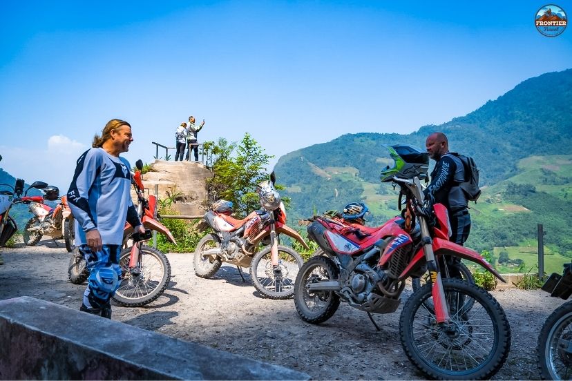
Selecting the right motorcycle model to ensure mechanical reliability on mountain passes.
5.1 Why 3–4 Days is the ideal balance
Most first-time travelers find that 3–4 days provides the best balance between sightseeing, cultural experiences, and comfortable riding schedules. It also reduces physical fatigue while creating enough flexibility for spontaneous stops and local exploration. It serves as the most realistic response to how long is the Ha Giang loop planning requirements for beginners.
5.2 Avoid treating the loop like a race
One of the biggest mistakes travelers make is trying to complete the loop as quickly as possible. The journey is designed to be experienced slowly, with time spent appreciating the landscapes, villages, and mountain atmosphere. Trying to speed through the mountains compromises your safety and limits your understanding of how long is the Ha Giang loop vacation value.
5.3 Longer itineraries create better cultural experiences
Additional travel days allow riders to spend more meaningful time inside local communities. Travelers can stay in traditional homestays, enjoy family meals, and experience the everyday lifestyle of Hmong, Tay, Dao, and Lo Lo ethnic groups. These slower cultural moments often become the emotional highlight of the entire journey, expanding your understanding of how long is the Ha Giang loop trip value beyond simple driving.
5.4 Weather flexibility is extremely important
Mountain weather in Northern Vietnam can change quickly, especially during winter and rainy seasons. Fog, rainstorms, or landslides occasionally force travelers to adjust their plans unexpectedly. Having an extra day available provides far greater flexibility and reduces stress during the trip, ensuring that weather anomalies do not ruin your schedule or alter how long is the Ha Giang loop ride safety.
6. Best route variations based on available time
To simplify your travel planning, you can choose from these primary route variations based on your personal time frame:
Exchanging smiles with ethnic villagers outside their timber longhouses.
- Best Route for 2 Days: Ha Giang City – Dong Van – Ma Pi Leng – Meo Vac – Ha Giang City. This fast-paced itinerary prioritizes the loop’s most famous highlights and dramatic mountain scenery. Travelers spend most of the trip riding with limited sightseeing time.
- Best Route for 3 Days: Classic route covering Ha Giang City – Quan Ba – Yen Minh – Dong Van – Meo Vac – Ha Giang City. This is the most common route variation and offers the best balance for most travelers visiting Ha Giang for the first time.
- Best Route for 4 Days: Extended route that includes Du Gia village, additional mountain backroads, scenic detours, and deep cultural experiences. This version allows a deeper exploration of Ha Giang’s remote landscapes.
- Best Route for 5 Days: Premium route including Lung Cu Flag Tower, Mau Due valley, hidden villages, and off-road sections. This comprehensive route answers how long is the Ha Giang loop query for those seeking the ultimate Northern Vietnam motorbike adventure.
7. Best time to ride the Ha Giang Loop
The changing seasons transform the landscape, traction conditions, and average travel speeds along the mountain passes.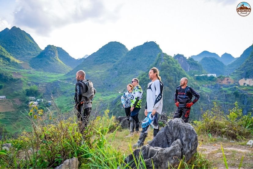
Organizing armored impact jackets and safety gear for a premium Ha Giang Loop departure.
- September to November (Golden Rice Season): This is considered the most beautiful season in Ha Giang thanks to golden rice terraces, cool temperatures, clear skies, and stable riding conditions.
- March to May (Green Mountain Season): Spring transforms the mountains into vibrant green landscapes with pleasant weather and comfortable riding temperatures throughout the region.
- Winter Cloud Season (December to February): Winter brings dramatic fog, cloud-covered mountain passes, and a quieter, colder atmosphere across the ethnic highlands.
- Rainy Adventure Season (June to August): Summer creates lush green scenery and powerful waterfalls, but slippery roads and reduced visibility make riding much more challenging.
No matter how long is the Ha Giang loop duration you choose, matching your skills to the season is crucial.
8. Essential travel tips before planning your loop
Before deciding on how long is the Ha Giang loop schedule for your trip, implement these vital preparations for a smooth mountain run: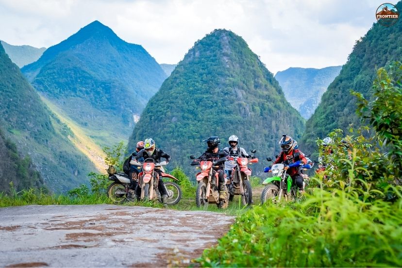
Debriefing riders on terrain ratings, daily distances, and evening basecamp facilities.
- Start Riding Early Each Morning: Morning conditions usually provide cooler temperatures, lighter traffic, and clearer visibility across the mountains.
- Respect the Mountain Terrain: Even experienced riders should avoid underestimating the technical difficulty of Ha Giang’s winding roads and steep mountain passes.
- Keep Your Itinerary Flexible: Unexpected weather changes can affect travel time significantly, so flexible schedules create a safer and less stressful experience.
- Consider Joining Guided Tours: Guided tours with Frontier help travelers navigate safely while discovering hidden routes, scenic viewpoints, and authentic cultural experiences throughout the journey.
9. FAQs – How long is the Ha Giang Loop?
To help travelers plan effectively, this section answers the most common questions regarding the distance, duration, and factors affecting the Ha Giang Loop journey. Understanding these points is crucial to choose the best time to do Ha Giang Loop while ensuring a safe and enjoyable ride.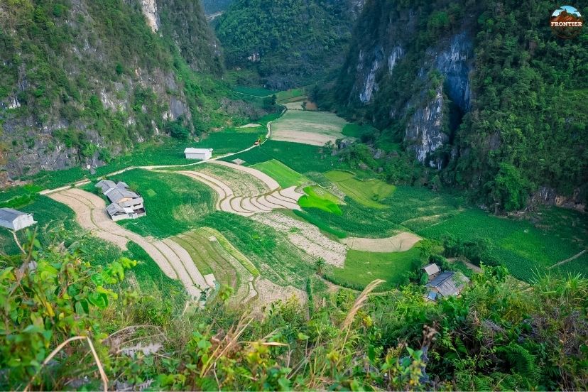
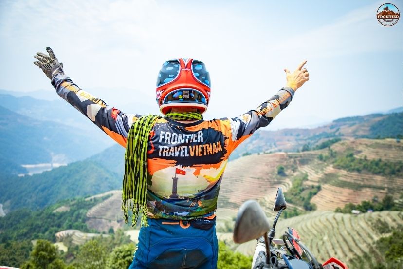
Embracing the freedom and dramatic landscapes at the end of an unforgettable
9.1 How many kilometers is the Ha Giang Loop?
The classic Ha Giang Loop spans roughly 350 to 400 kilometers in total distance. However, this number can easily increase if you decide to take scenic detours through local villages, visit the Lung Cu Flag Tower, or explore deeper hidden valleys like Du Gia along the way.
9.2 How many days are recommended for first-time riders?
For most first-time travelers, a duration of 3 to 4 days is highly recommended. This time frame allows you to ride at a very safe, comfortable pace, safely navigate the winding mountain passes, and still leaves plenty of daylight hours for sightseeing, photography, and cultural interactions.
9.3 Can the loop be completed in 2 days?
Yes, it is possible to complete the circuit in 2 days, but it is not recommended for most tourists. This fast-paced option requires long, exhausting hours in the saddle with very minimal time for rest or taking photos, making it highly demanding both physically and mentally.
9.4 Is 4 days enough for the full experience?
Yes, 4 days is universally considered the ideal sweet spot for the loop. It gives you the perfect balance of adventure and comfort, providing enough flexibility to take the highly scenic southern detour through Mau Due and Du Gia village without ever feeling rushed.
9.5 Does weather affect travel time on the loop?
Absolutely. High-altitude mountain weather in Northern Vietnam changes rapidly. Unexpected rain, thick fog blocks, and seasonal landslides can severely reduce visibility and traction, forcing riders to slow down significantly and directly impacting how long is the Ha Giang loop daily transit time.
10. Conclusion
Understanding how long is the Ha Giang loop is essential for planning the right kind of adventure through Northern Vietnam’s breathtaking mountains. While the classic route covers approximately 350–400 kilometers, the real experience depends far more on riding pace, weather conditions, scenic stops, and cultural exploration than distance alone.
With careful preparation and expert support from Frontier Travel Vietnam, riders can fully enjoy the freedom, landscapes, and authentic cultural encounters that make Ha Giang one of the world’s most iconic motorcycle destinations. Knowing exactly how long is the Ha Giang loop helps you set realistic expectations for an incredible holiday.