The Ha Giang Loop Vietnam map reveals one of the most spectacular motorbike adventures in Southeast Asia, guiding travelers through towering limestone mountains, dramatic mountain passes, remote ethnic villages, and breathtaking river valleys.
With expert support from Frontier Travel Vietnam, understanding the Ha Giang Loop map helps riders plan safer journeys, discover iconic landmarks, and explore Northern Vietnam’s most unforgettable landscapes with confidence.
1. What Is the Ha Giang Loop Vietnam Map?
The Ha Giang loop Vietnam map is a route guide designed to help travelers navigate Northern Vietnam’s most famous motorbike adventure. The loop connects remote mountain towns, legendary passes, ethnic villages, river valleys, and UNESCO-recognized geological landscapes across Ha Giang Province. It acts as a visual and logistical lifeline for motorists attempting to conquer the northernmost frontier of the country.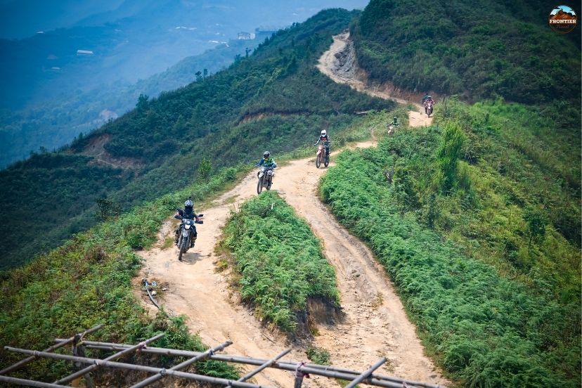
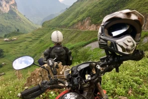
Reviewing primary highway layouts on a Ha Giang Loop Vietnam map.
For most riders, studying the Ha Giang loop Vietnam becomes an essential part of planning the journey because road quality, weather conditions, and riding distances can change dramatically between regions. A single landslide or heavy downpour can turn an easy two-hour cruise into a four-hour technical challenge, making an accurate geographical layout indispensable.
2. Overview of the Main Ha Giang Loop route
The core highway system of the far north forms a circular track that cuts through diverse topographies, each offering a distinct chapter of the overland journey. By following this established path, motorists can ensure they hit all major municipal hubs while maintaining a safe and logical progression.
Entering the grand loop system from the southern lowlands.
2.1 Ha Giang City – The Starting Point
Most travelers begin their journey in Ha Giang City, the gateway to Northern Vietnam’s mountainous frontier. Before entering the loop, riders usually organize permits, inspect motorcycles, prepare luggage, and meet local guides. Many guided tours with Frontier also begin here, helping riders understand route conditions, safety information, and daily itineraries before heading out into the highlands with their ha giang loop Vietnam map.
2.2 Quan Ba – Entrance to the Highlands
Quan Ba marks the true beginning of the mountain adventure on the Ha Giang loop Vietnam map. The road climbs rapidly through steep valleys toward Quan Ba Heaven Gate, one of the most famous viewpoints in Ha Giang. This section introduces travelers to winding mountain roads, cool air, limestone peaks, and panoramic valley scenery.
2.3 Yen Minh – Pine Forests & Peaceful Valleys
The route between Quan Ba and Yen Minh offers smoother roads and more relaxing scenery compared to the dramatic passes deeper into the loop. Yen Minh is often used as an overnight stop on the Ha Giang loop Vietnam map where riders can enjoy local food, quiet countryside views, and traditional village life before continuing toward Dong Van and Meo Vac.
2.4 Dong Van – The Heart of the Karst Plateau
Dong Van sits at the center of the UNESCO-listed Dong Van Karst Plateau, one of the most unique geological regions in Southeast Asia. Travelers often stay overnight in Dong Van to experience local markets, mountain culture, and the old quarter atmosphere. The roads leading into the town are among the most scenic sections of the entire Ha Giang loop Vietnam map.
2.5 Ma Pi Leng Pass – Vietnam’s Most Iconic Mountain Road
Ma Pi Leng Pass is considered the highlight of the journey and one of the most spectacular mountain roads in Vietnam. The route follows steep cliffs high above the emerald-green Nho Que River, offering breathtaking panoramic views. This section is an absolute must-see landmark on the ha giang loop Vietnam map and is one of the most photographed destinations in Northern Vietnam.
2.6 Meo Vac – Remote Mountain Frontier
After descending from Ma Pi Leng Pass, riders arrive in Meo Vac, a remote highland region surrounded by rocky mountains and isolated valleys. Compared to Dong Van, Meo Vac feels quieter and less touristy, offering a more authentic atmosphere on the Ha Giang loop Vietnam map. The area is home to several ethnic minority groups whose traditional lifestyles remain deeply connected to the mountains.
3. Most scenic stops on the Ha Giang Loop Map
To maximize the visual reward of your motorcycle tour, you should prioritize several major geographical landmarks that define the visual aesthetic of the region. These selected locations provide riders with safe pull-off zones to appreciate the monumental scale of the limestone terrain.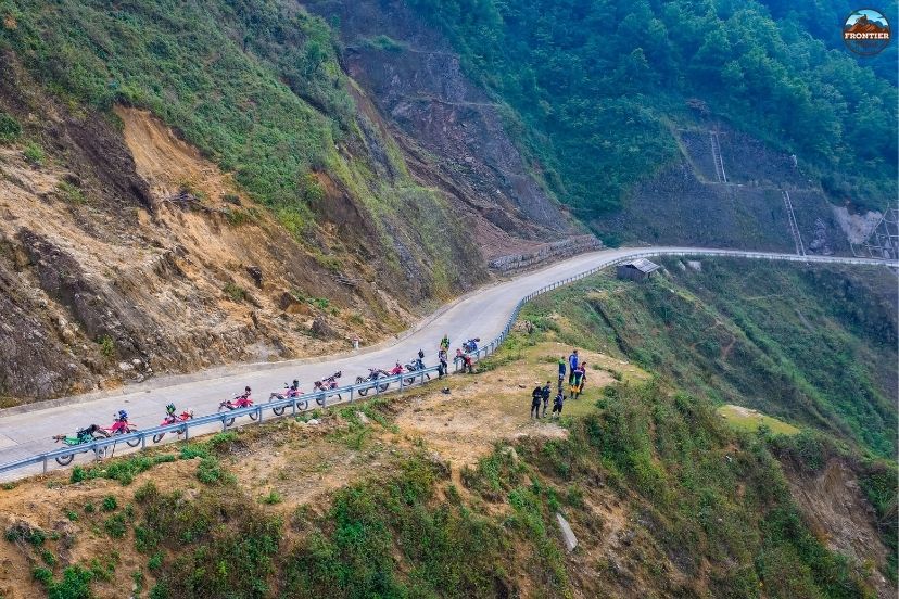
Marking key coordinates for the most dramatic scenic viewpoints
3.1 Quan Ba Heaven Gate
Quan Ba Heaven Gate is one of the first major viewpoints travelers encounter after entering Ha Giang’s mountain region. From the top, riders can admire sweeping views across valleys, limestone peaks, winding roads, and the famous Twin Mountains below.
The viewpoint is especially beautiful during sunrise and sunset, when clouds drift across the mountains and soft light spreads over the valleys, providing an epic photo stop on the Ha Giang loop Vietnam.
3.2 Dong Van Karst Plateau
The Dong Van Karst Plateau is one of Vietnam’s most extraordinary geological landscapes. Massive limestone formations stretch endlessly across the horizon, creating a rugged and dramatic atmosphere unlike anywhere else in the country. Riding through this area on the Ha Giang loop Vietnam map feels remote and adventurous, especially as travelers pass isolated villages hidden between the rocky mountains.
3.3 Ma Pi Leng Skywalk
The Ma Pi Leng Skywalk offers one of the most thrilling viewpoints on the entire loop. This narrow trail follows the edge of steep cliffs high above the Nho Que River canyon. Travelers who track this path on the Ha Giang loop Vietnam map can experience the enormous scale of the mountains and valleys from a completely different perspective, standing on rock shelves that hang directly over the abyss.
3.4 Nho Que River
Flowing beneath Ma Pi Leng Pass, the Nho Que River creates one of the most iconic landscapes in Northern Vietnam. Its emerald-green water cuts through towering limestone canyons, forming an unforgettable natural scene. Boat trips along the river have become increasingly popular on the Ha Giang loop Vietnam map because they allow travelers to experience the canyon from below while surrounded by dramatic mountain walls.
3.5 Lung Cu Flag Tower
Located near the Chinese border, Lung Cu Flag Tower marks Vietnam’s northernmost point. The climb to the top rewards travelers with panoramic views across valleys, mountains, and frontier landscapes. Besides its scenery, Lung Cu also carries important cultural and historical significance, making it one of the most symbolic destinations to mark on your ha giang loop Vietnam map.
4. Popular route variations on the Ha Giang Loop Vietnam Map
Every traveler has a different schedule and riding style, which is why the main circular highway can be broken down into various specialized track alternatives. Choosing the correct variant allows you to match your daily saddle hours with your physical stamina limits.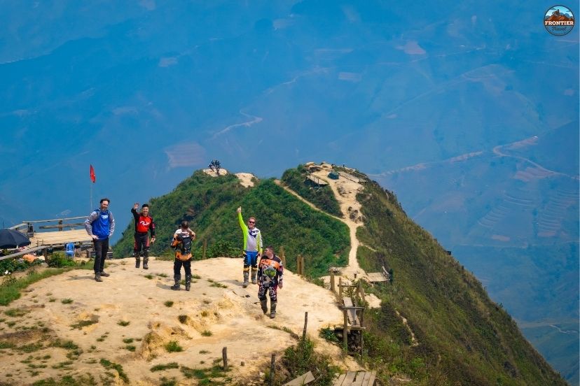
Customizing your geographic itinerary based on experience and available days.
4.1 Classic 3-Day Ha Giang Loop
The classic route usually follows a direct line: Ha Giang – Quan Ba – Yen Minh – Dong Van – Meo Vac – Ha Giang. This itinerary covers the most famous highlights while remaining manageable for most travelers and beginner riders who want a concise experience on the Ha Giang loop Vietnam map. It minimizes backroad detours in favor of the most well-maintained primary highways.
4.2 Extended 4–5 day adventure route
Longer itineraries on the Ha Giang loop Vietnam map include additional scenic backroads, remote villages, and hidden valleys that are often skipped on shorter trips. These routes allow travelers to experience a deeper connection with local culture, spend more time exploring lesser-known mountain regions, and reduce daily saddle hours to prevent physical exhaustion.
4.3 Off-the-beaten-path mountain routes
Experienced riders often explore remote roads leading toward Du Gia, Mau Due, and isolated highland communities beyond the main tourist track. These sections on the Ha Giang loop Vietnam map usually feature rougher terrain, fewer tourists, and more untouched natural scenery.
4.4 Scenic photography routes
Some travelers plan their routes specifically around photography opportunities such as sunrise viewpoints, cloud-hunting locations, and rice terrace landscapes. Autumn and winter are especially popular seasons for photography-focused itineraries, forcing riders to time their pass crossings perfectly according to the local climate maps.
5. Understanding road conditions on the map
The physical state of the mountain roads plays a massive role in dictating your safety margins and daily average travel speeds. Being mentally prepared for varying track conditions prevents panic when navigating unfamiliar mountain passes.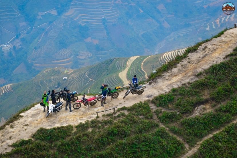
Preparing for rapid transitions in paving quality along the border highways
5.1 Mountain passes & sharp curves
The far north is famous for steep mountain roads filled with switchbacks, blind corners, and rapid elevation changes. Riders must remain completely focused on the asphalt, especially in high mountain sections like Ma Pi Leng Pass. The technical nature of these corners is one of the reasons the ha giang loop Vietnam map attracts adventure riders from around the world who want to test their cornering lean angles.
5.2 Paved vs rough roads
Most of the main highway system is paved and suitable for standard motorbike travel. However, some secondary roads and village routes on the ha giang loop Vietnam map may include potholes, loose gravel, or damaged surfaces caused by mountain weather. Road quality can also vary depending on recent heavy rain, structural wear, and seasonal roadwork conditions.
5.3 Weather impact on riding conditions
Fog, rain, and unexpected landslides can significantly affect visibility and safety, particularly during the summer rainy season and cold winter months. Mountain weather changes quickly, meaning riders tracking the Ha Giang loop Vietnam map should always check local forecasts before departure and be prepared to seek shelter if a storm rolls over the ridges.
5.4 Fuel stations & local services
Fuel stations are available along the main loop but become less frequent in remote mountain regions. Riders should refill regularly and avoid entering isolated sections with low fuel on their Ha Giang loop Vietnam map. Small repair shops and local mechanics can also be found in major towns such as Yen Minh, Dong Van, and Meo Vac to handle flat tires.
6. Best time to explore the Ha Giang Loop Vietnam map
The look and feel of the northern frontier rotate dramatically alongside the seasonal calendar, altering traction and visibility conditions. Selecting your travel window carefully directly shapes the background colors of your journey.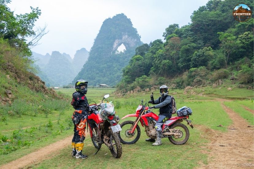
Aligning your departure date with the changing climate cycles of the highlands.
6.1 September to November – Golden rice season
This is considered the best season to explore the Ha Giang loop Vietnam map thanks to golden rice terraces, clear skies, cool temperatures, and excellent visibility across the international borders. The landscapes become especially photogenic during the annual autumn harvest season, attracting riders and landscape photographers from around the world.
6.2 March to May – Spring green season
Spring transforms the mountains into lush green landscapes filled with fresh vegetation and comfortable riding temperatures. Road conditions are generally stable on the ha giang loop Vietnam map, making this one of the best periods for first-time travelers who want to avoid extreme cold or heavy monsoon mud tracks.
6.3 December to February – Winter cloud season
Winter creates dramatic scenery with fog-covered valleys, cloud-filled mountain passes, and quiet ethnic villages. The atmosphere becomes more cinematic and mysterious on the Ha Giang loop Vietnam, although temperatures can drop significantly at higher elevations, requiring proper technical thermal riding gear.
6.4 June to August – Rainy adventure season
Heavy rainfall during summer creates vibrant green mountains and powerful waterfalls throughout the region. However, slippery roads, localized landslides, and reduced visibility make this the most challenging season for riding. It is rarely marked as the ideal window on the Ha Giang loop Vietnam for casual tourists.
7. Essential navigation tips for the Ha Giang Loop
Staying on course requires a blend of modern digital tools and traditional defensive driving wisdom.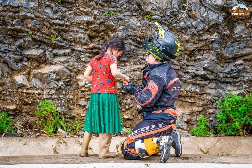
Essential safety and directional practices for high-altitude motorists tracking
- Download Comprehensive Offline Maps: Mobile signal can become weak or completely non-existent in deep stone canyons, so downloading a digital Ha Giang loop Vietnam map before departure is highly recommended to avoid navigation errors.
- Start Riding Early Each Morning: Morning departures provide cooler temperatures, better lighting conditions, and improved visibility in the mountains. Early starts also allow riders to complete their daily Ha Giang loop Vietnam milestones before the afternoon fog rolls in.
- Avoid Riding at Night: Night riding in Ha Giang can be exceptionally dangerous due to a complete lack of street lighting, thick fog, animals crossing roads, and limited visibility in mountain passes. Aim to arrive at accommodations before sunset.
- Join Guided Tours for Better Navigation: Guided tours with Frontier help travelers navigate difficult roads more safely while discovering hidden viewpoints and cultural experiences beyond the standard Ha Giang loop Vietnam route, ensuring peace of mind.
8. Best motorcycles for exploring the Ha Giang Loop
Your choice of two-wheeled machinery directly dictates your comfort, safety margins, and climbing power on the steep mountain inclines. Selecting an underpowered vehicle can lead to engine strain on the long uphill ascents.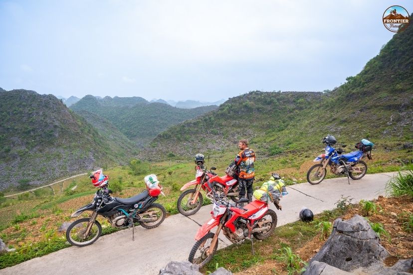
Evaluating power-to-weight ratios for heavy mountain touring demands.
8.1 Honda CRF300L
The Honda CRF300L is one of the most popular choices for the ha giang loop Vietnam map thanks to its lightweight dual-sport design, reliable fuel-injected handling, and long-travel suspension for rugged mountain terrain. It performs exceptionally well on both smooth paved roads and rougher off-road dirt tracks.
8.2 Yamaha WR250R
The Yamaha WR250R is highly respected among adventure riders because of its high-revving agility and technical riding performance. Its advanced suspension system handles steep climbs and uneven mountain roads comfortably, making it a premium choice for mapping out remote mountain trails.
8.3 Kawasaki KLX 250
The KLX 250 offers balanced power, low seat comfort, and long-term mechanical reliability, making it suitable for both beginners and experienced riders. Its lightweight frame helps riders navigate narrow mountain curves on the ha giang loop Vietnam map more confidently.
8.4 Touring Adventure Bikes
Larger touring motorcycles such as the Yamaha Tenere 700 or Honda Transalp 750 provide additional wind protection and seat comfort for experienced long-distance riders. These bikes are ideal for travelers wanting stronger highway performance and premium touring capability across the vast stretches of the Ha Giang loop Vietnam map.
9. Who should experience the Ha Giang Loop?
This high-altitude overland loop is suited for outdoor enthusiasts who appreciate expansive wilderness and raw cultural exchange. It calls out to international wanderers who prefer unfiltered immersion over curated urban resorts.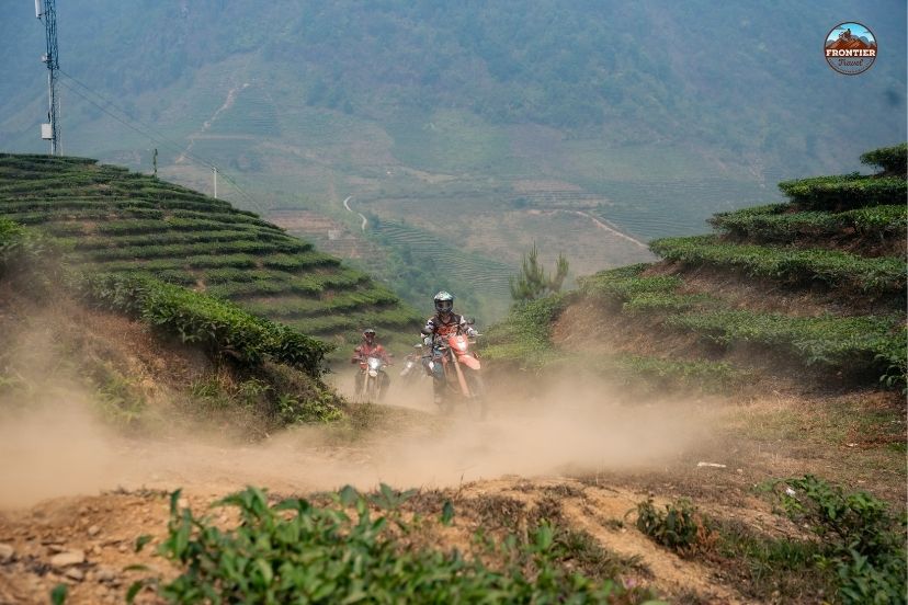
Matching target traveler profiles with the raw realities of the far north
9.1 Adventure Riders
The loop is perfect for riders seeking technical mountain roads, dramatic elevation changes, and long-distance adventure riding experiences. The constantly changing terrain creates a rewarding challenge for motorcycle enthusiasts looking to test their skills using a comprehensive Ha Giang loop Vietnam map.
9.2 Landscape Photographers
Ha Giang offers some of the most photogenic scenery in Vietnam, from limestone mountains and golden rice terraces to deep river canyons and cloud-covered peaks. Every single season transforms the province into a completely different visual experience, making the Ha Giang loop Vietnam map a dream guide for creative visual artists.
9.3 Cultural Travelers
The journey passes through Hmong, Dao, Tay, and Lo Lo communities where traditional lifestyles remain deeply connected to the mountains. Travelers can experience local highland markets, traditional clay homes, and authentic frontier culture throughout every stop on the Ha Giang loop Vietnam map.
10. FAQs – Ha Giang Loop Vietnam map
To help clear up any remaining route questions, here are direct answers regarding the geography of the northern circuit.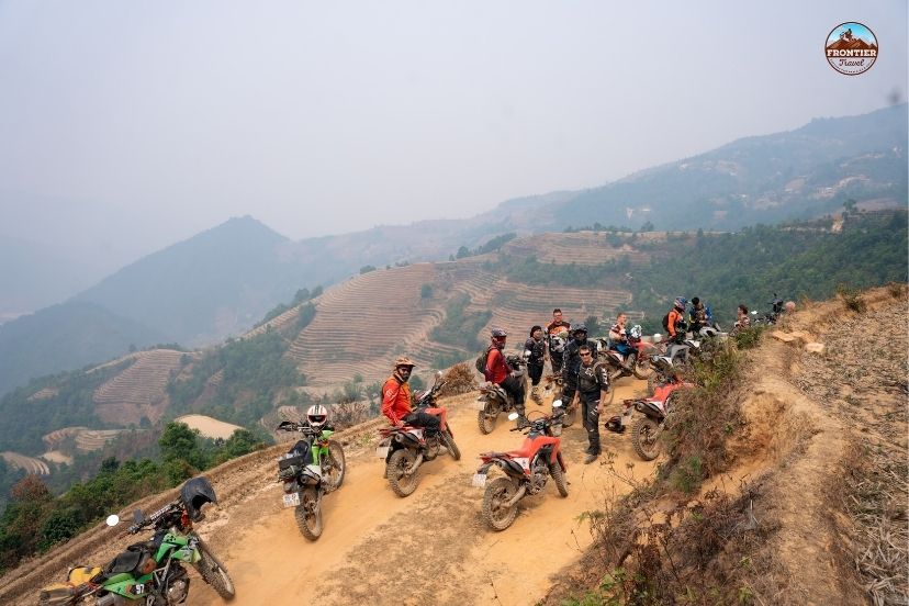
Resolving key geographic and entry inquiries for global motorists.
10.1 How long is the Ha Giang Loop route?
The classic primary loop is approximately 350 to 400 kilometers long, depending on specific route variations, village detours, and how far north you drive toward the border checkpoints on your Ha Giang loop Vietnam map.
10.2 How many days are ideal to complete the map?
Most travelers spend 3 to 5 days completing the full route comfortably. A 4-day plan allows for a perfectly balanced daily riding pace while still leaving ample time for photography and cultural sightseeing stops along the highway.
10.3 Is the route layout difficult for beginner riders?
Yes, some mountain sections can be highly technical, especially during unexpected rain or low-lying fog walls. Absolute beginners should ride with caution, travel at slow speeds, or join a guided Frontier tour as an easyrider pillion passenger.
10.4 Can travelers rely entirely on Google Maps?
Yes, but downloading an offline ha giang loop Vietnam map is strongly recommended because mobile data signals can be highly unreliable when traveling through deep limestone mountain passes and isolated border valleys.
11. Conclusion
The Ha Giang loop Vietnam map is more than just a basic navigation tool—it is the key to unlocking one of Southeast Asia’s greatest motorbike adventures. From legendary passes like Ma Pi Leng and remote ethnic villages to dramatic limestone plateaus and hidden valleys, every single section of the route delivers unforgettable scenery and authentic cultural encounters on the road.
With careful planning and professional track support from Frontier Travel Vietnam, travelers can confidently explore Northern Vietnam’s most iconic roads while experiencing the true spirit of adventure across Ha Giang’s breathtaking mountain frontier.