The Ha Giang loop scenery is a living, breathing canvas of jagged peaks, deep valleys, and roads that twist like ribbons into the clouds. But here is the hard truth: if you try to swallow this massive landscape in a rushed 2 or 3-day sprint, you will spend your entire trip staring at the taillights of a crowded convoy, completely missing the magic. Follow Frontier Travel Vietnam as we explore the breathtakingly beautiful landscapes of Ha Giang.
1. The Anatomy of the Landscape: What Makes Ha Giang Unique
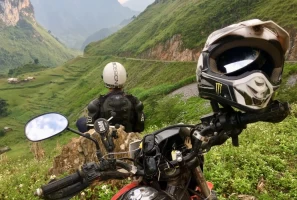
The extreme northern border of Vietnam contains a mesmerizing geographic transition where ancient tectonic forces have sculpted an incomparable mountain landscape. Visual creators and adventure travelers will find a vast territory defined by sharp structural contrasts, deep physical textures, and highly dynamic weather patterns that alter the horizon by the minute.
Geological formations enhance Ha Giang loop scenery
1.1. The UNESCO Karst Topology
Jagged karst towers dominate the ancient high-altitude northern landscape. The primary allure of the regional Ha Giang loop scenery stems directly from its protected status as the Dong Van Karst Plateau UNESCO Global Geopark. This massive 2,356-square-kilometer reserve contains a spectacular concentration of dark limestone needles, deep structural fault lines, and steep canyons that date back over 600 million years.
This harsh, gray stone matrix on Ha Giang Loop Motorbike Tour is beautifully broken up by the vivid, hand-woven textiles worn by the indigenous H'Mong, Dao, and Tay ethnic groups who build their ancestral homesteads directly on the precipitous mountain rock faces. Local communities display incredible resilience by carving vibrant, stepped agricultural terraced farms into the narrow gaps between the stone peaks.
1.2. The Tragedy of the Rushed Glance
Harsh midday solar glare flattens deep mountain valley definitions. Attempting to document the vast Ha Giang loop scenery on a compressed two-day or three-day commercial itinerary is a major error that turns a magnificent journey into a stressful race against the clock. Fast-paced budget tours often force riders through the most spectacular viewpoints during the middle of the day, when harsh overhead sunlight flattens structural details and washes out rich color saturation.
Conversely, an extended five-day or seven-day timeline provides the critical breathing room required to watch shifting weather systems roll gracefully across the high peaks, creating dramatic atmospheric transitions. Taking a slow, calculated approach ensures you are perfectly positioned on elevated ridges when the low-lying alpine mist settles perfectly between the limestone towers during the golden hours of sunrise and sunset.
2. The Masterpieces: Iconic Viewpoints of the Ha Giang loop scenery
The northern loop contains multiple world-famous overlooks that require precise arrival timing to unlock professional-grade visual quality. Each district along the international boundary line features a distinct geological profile, shifting seamlessly from soft agricultural hills to vertical cliff faces that drop straight down into pristine river basins.
2.1. The Gateway Vistas (Hanoi to Yen Minh)
The southern entrance districts present immediate elevation changes that expand the horizon. Let us look at the first two major landmarks that define the entrance to this high-altitude alpine world.
2.1.1. Quan Ba Heaven’s Gate
Sunrise mountain gaps reveal incredible multi-layered atmospheric cloud views. The first major elevation shift occurs as the road scales a steep mountain gap located exactly 43 kilometers north of the city center, reaching an altitude of over 1,000 meters above sea level.
At this summit, an old stone lookout platform provides a sweeping panoramic perspective of the ribbon-like national highway winding down into the misty valley below. This elevated viewpoint captures the dramatic depth of Ha Giang loop scenery at its most atmospheric. The optimal shooting window opens between 07:00 AM and 08:30 AM, when the rising sun casts long, directional shadows across the distant pine forests while the low-lying valley fog begins to dissipate.
Route planning helps riders capture the best light
2.1.2. The Twin Mountains (Co Tien)
Symmetrical geological hills contrast beautifully with flat alluvial green plains. Rising directly from the flat alluvial floor of the Tam Son valley are two perfectly symmetrical, conical limestone hills that have inspired regional folklore for centuries.
Capturing this unique landform requires a medium telephoto focal length to compress the architectural layers of the surrounding ethnic villages against the round hills. Photographers should frame these formations against the shifting seasonal colors of the agricultural fields below, capturing either the flooded mirror reflections of spring or the rich greens of summer.
Moving past the gateway districts, Ha Giang loop scenery transforms into an ancient world of pure, dark stone. Welcome to the heart of the UNESCO Geopark, where dramatic engineering marvels and historic fortresses await your creative eye.
2.2. The High Karst Vistas (Dong Van Geopark)
The massive stone fortress of the northern plateau demands sharp focus and strong geometric framing. This sector features the most celebrated roadway switchbacks and remote border ridges on your entire northern track.
2.2.1. Tham Ma Pass Lookout
Elevated summit lookouts reveal the complete geometric profile of hairpin turns. This legendary nine-turn zigzag pass serves as the definitive visual symbol of adventure travel across Northern Vietnam, scaling a steep limestone cliff to connect two major valley basins.
To capture the full geometric beauty of these sweeping hairpins and dramatic Ha Giang loop scenery, photographers should safely hike to a natural rock ledge above the upper parking area. Using a wide-angle lens allows you to frame approaching motorcycle convoys as they lean into the sharp, uniform curves below, perfectly illustrating the scale of human engineering cutting through the mountains.
2.2.2. Chin Khoanh Pass (The Nine Ramps)
Sweeping northern border passes display the raw majesty of limestone insulation. This spectacular, lesser-known mountain pass features a series of consecutive, high-gradient hairpin turns that test a rider's clutch modulation and throttle discipline.
The surrounding landscape is incredibly raw and quiet, characterized by massive fields of jagged gray rocks that stretch directly toward the Chinese border. Standing at the upper crest of the pass offers an unmatched view of the vast, quiet karst topography, providing a stark contrast to the busy commercial zones found on shorter tours.
2.3. The Ultimate Chasm (Meo Vac Border Region)
The boundary line between Dong Van and Meo Vac contains the most visually explosive terrain in Southeast Asia. Let us explore how to safely frame these monumental vertical cliffs from both elevated ridges and low-angle water levels.
2.3.1. The Ma Pi Leng Pass Skywalk
Precipitous cliff ledges frame tiny rider silhouettes against deep canyons. This incredible stretch of national highway clings tightly to sheer vertical cliff faces that drop 1,000 meters directly into the river canyon below. To capture the true, heart-stopping scale of this pass, photographers should safely walk along the old suspension path known as the Skywalk rim.
From this elevated vantage point, a standard wide lens can frame a single motorcycle rider as a tiny silhouette against the massive mountain walls, emphasizing the grand scale of the surrounding Ha Giang loop scenery.
2.3.2. Capturing Ha Giang loop scenery at Tu San Canyon and Nho Que River
Towering vertical walls dominate frames from low angle water viewpoints. Transitioning from the high mountain ridges down to the actual water level reveals an entirely new perspective on the Tu San Canyon. Boarding a small watercraft allows travelers to look straight up at the towering vertical cliffs that form the deepest gorge in Southeast Asia.
This low-angle view highlights the incredible contrast between the sheer, dark limestone walls and the brilliant turquoise water surface below. The towering canyon walls naturally block direct sunlight, creating beautifully soft, evenly distributed lighting conditions that are perfect for capturing rich color saturations.
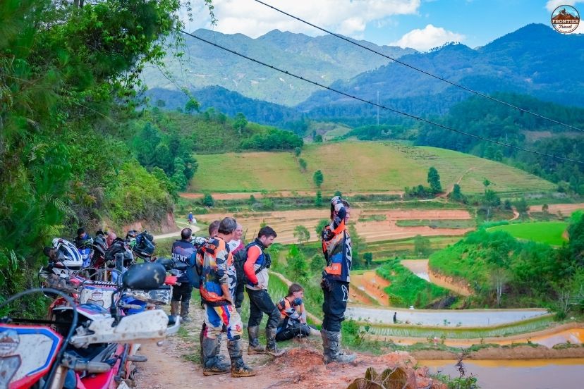
3. Choosing Your Style: Easy Rider Comfort vs. Self-Ride Freedom
The extreme vertical nature of Ha Giang Loop Motorbike Tour leaves zero margin for substandard machinery or overconfident riding habits. Every participant must make an honest assessment of their personal physical stamina, mechanical experience, and comfort levels regarding high-altitude exposure.
3.1. The Easy Rider Experience (Pillion Passenger)
Experienced local pillion drivers navigate tight hairpin curves with confidence. Choosing our professional Easy Rider service allows non-riders and photographers to enjoy spectacular Ha Giang loop scenery without the stress of handling a motorcycle on narrow mountain roads.
You sit comfortably on a cushioned pillion seat while a certified, highly experienced local guide handles the complex weight distributions, braking points, and lean angles required for mountain hairpins. This arrangement eliminates all navigating stress, allowing you to capture stunning high-definition media files while moving smoothly through the valleys. It remains the absolute safest and most relaxing method to experience the extreme geography of the north.

Adventure motorcycles improve steep-pass stability
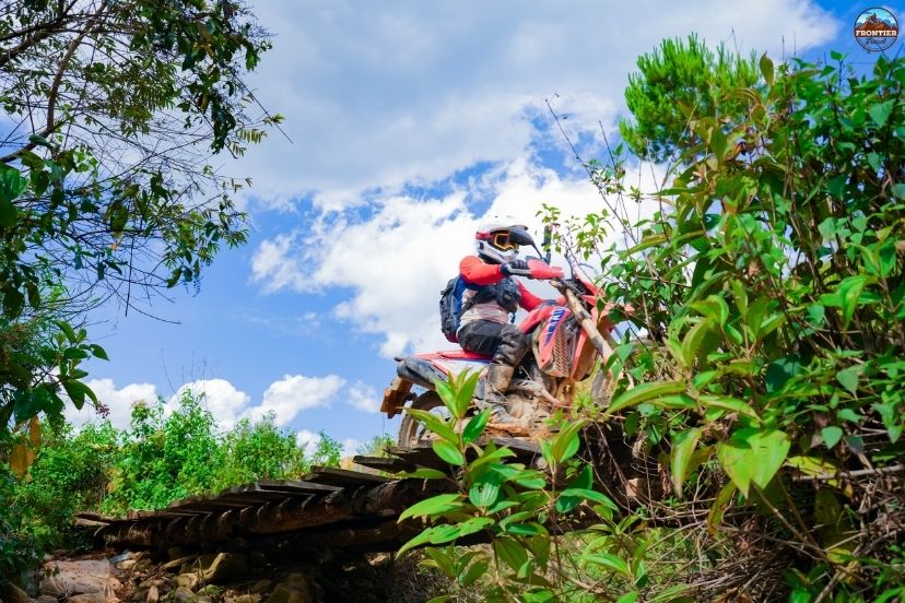
3.2. The Self-Drive Challenge
Valid driving documents are essential when exploring remote Ha Giang loop scenery. Self-drive participants must carry a licence recognized for motorcycle use in Vietnam, such as an applicable 1968 Convention International Driving Permit paired with the corresponding home-country motorcycle licence. These documents may be checked by authorities during the journey, while advanced riding awareness and sharp reflexes remain vital across rugged mountain roads.
The physical strain of managing continuous, tight mountain curves for multiple consecutive days requires excellent wrist and core stabilization. Our training team conducts exhaustive pre-trip orientations to ensure every self-ride client fully understands local traffic etiquette before entering public roads.
4. Practical Survival Guide for the Open Road
Conquering the extreme terrain of the far north safely requires an uncompromising approach to roadway discipline, protective equipment standards, and defensive driving techniques. The steep passes and blind corners leave absolutely zero margin for operational negligence or low-quality safety gear.
4.1. Navigating Mountain Traffic and Blind Corners
Sounding your horn on blind horseshoe curves alerts oncoming commercial vehicles. While exploring dramatic Ha Giang loop scenery, riders must remember that narrow northern highways are shared with construction trucks, local buses, and roaming livestock that may suddenly appear around blind bends. Maintaining strict lane discipline is vital, with riders remaining safely within their lane through every horseshoe curve.
Self-drive riders should use engine braking appropriately rather than relying continuously on friction brakes during long descents, helping reduce brake overheating. Sounding the motorcycle horn before entering tight blind bends also helps alert oncoming drivers to your presence.
Beyond mastering your defensive driving techniques, your physical safety relies heavily on the quality of your personal protective apparel and layering strategies. Let us look at the mandatory gear protocols enforced by our support marshals to protect your skeletal structure against environmental hazards.
Defensive riding protects convoys from traffic hazards
4.2. Essential Gear and Layering
Impact-rated protective gear provides essential support when exploring rugged Ha Giang loop scenery. We enforce a strict safety policy for all group departures, requiring certified full-face or dual-sport helmets paired with anti-fog goggles. Riders should also wear reinforced elbow pads, articulated knee protection, and heavy-duty motorcycle gloves to reduce injury risks during low-speed falls on gravel sections.
Additionally, mountain weather is highly unpredictable, with temperatures dropping by up to 15°C as you ascend into the high-altitude cloud layers. Packing a lightweight, windproof waterproof layer within your riding pack ensures you stay warm, dry, and mentally sharp on the throttle throughout the day.
5. Frequently Asked Questions (FAQ)
Planning a dedicated documentary expedition through extreme mountain terrain requires clear answers regarding equipment safety and local regulations. Our professional media team has compiled answers to the most common questions asked by incoming camera operators.
5.1. Is this tour suitable for beginners to enjoy the scenery?
Yes, absolutely, but we provide specialized options to match your comfort level. To enjoy the stunning Ha Giang loop scenery without managing a motorcycle on sharp hairpins, our Easy Rider option is highly recommended. For self-riders with basic experience, we can adapt the daily route to follow smoother, well-paved mountain roads while avoiding the most technical unpaved tracks.
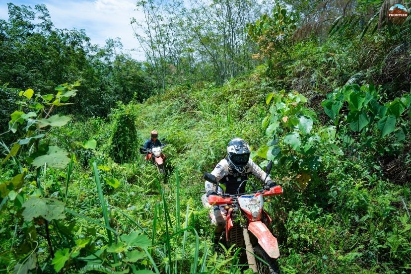
5.2. How much off-road vs on-road riding is included?
The balance of terrain depends entirely on your chosen tour package and riding experience. Our standard scenic routes stick primarily to the main paved national highways, which still offer incredible exposure to the limestone peaks. However, for advanced riders seeking pure isolation, we can customize your itinerary to include 50% to 60% unpaved backcountry trails that lead deep into remote border landscapes.
Professional support vehicle fleets secure heavy gear
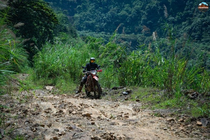
5.3. What motorbikes do you provide to handle these steep mountain walls?
Exploring dramatic Ha Giang loop scenery requires motorcycles suited to steep passes and changing road conditions. Our private fleet includes high-clearance dual-sport models such as the Honda CRF300L and Kawasaki KLX, selected for their long-travel suspension and responsive disc braking systems. Our mechanical team can also adjust suspension preload and riding ergonomics for taller or heavier riders, helping maintain comfort and control on demanding mountain inclines.
5.4. What are the scenic accommodations like?
We arrange a curated mix of comfortable hotels and authentic local homestays that position you directly in front of the finest landscapes. You will stay in a new town each night, waking up to stunning views of misty valleys or sweeping rice terraces. Every property is thoroughly vetted for cleanliness, hot water facilities, and secure motorcycle parking.
6. Conclusion
Trying to witness the full grandeur of the Ha Giang loop scenery on a frantic, short-day schedule is like trying to appreciate a masterpiece painting from a speeding train. Rushing through these majestic limestone canyons and legendary passes strips away the magic, leaving you with nothing but road fatigue and hurried snapshots. Stop looking at photos from behind a desk and go live the view; leave the logistics to the open-road specialists and book your extended journey with Frontier Travel Vietnam today to experience the wild North in its true, unhurried glory!